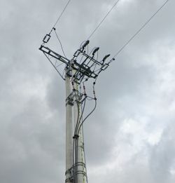
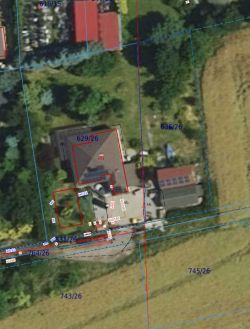
Hello, a family member wants to buy a plot of land where an overhead power line runs across the boundary. There are three wires. The poles with insulators are far from the plot, One of them can be seen on a google map. I am pasting below. What voltage runs on this line? On the geoportal the line is marked in red and there are two arrows. But I don't think it is a high voltage line. It looks more like medium voltage.
A pole is where the line comes out of the ground and continues on air.
What could be the minimum distance of a development from such a line? Looking at the neighbours it is about 6-8m.
If it's a WN line this certainly disqualifies this plot.
 .
.
The distance of the buildings from the line in some places seems really small so why are the lines marked with two arrows on the map as if it was a WN line?

A pole is where the line comes out of the ground and continues on air.
What could be the minimum distance of a development from such a line? Looking at the neighbours it is about 6-8m.
If it's a WN line this certainly disqualifies this plot.
 .
.
The distance of the buildings from the line in some places seems really small so why are the lines marked with two arrows on the map as if it was a WN line?


